Advancing
Rice
Monitoring


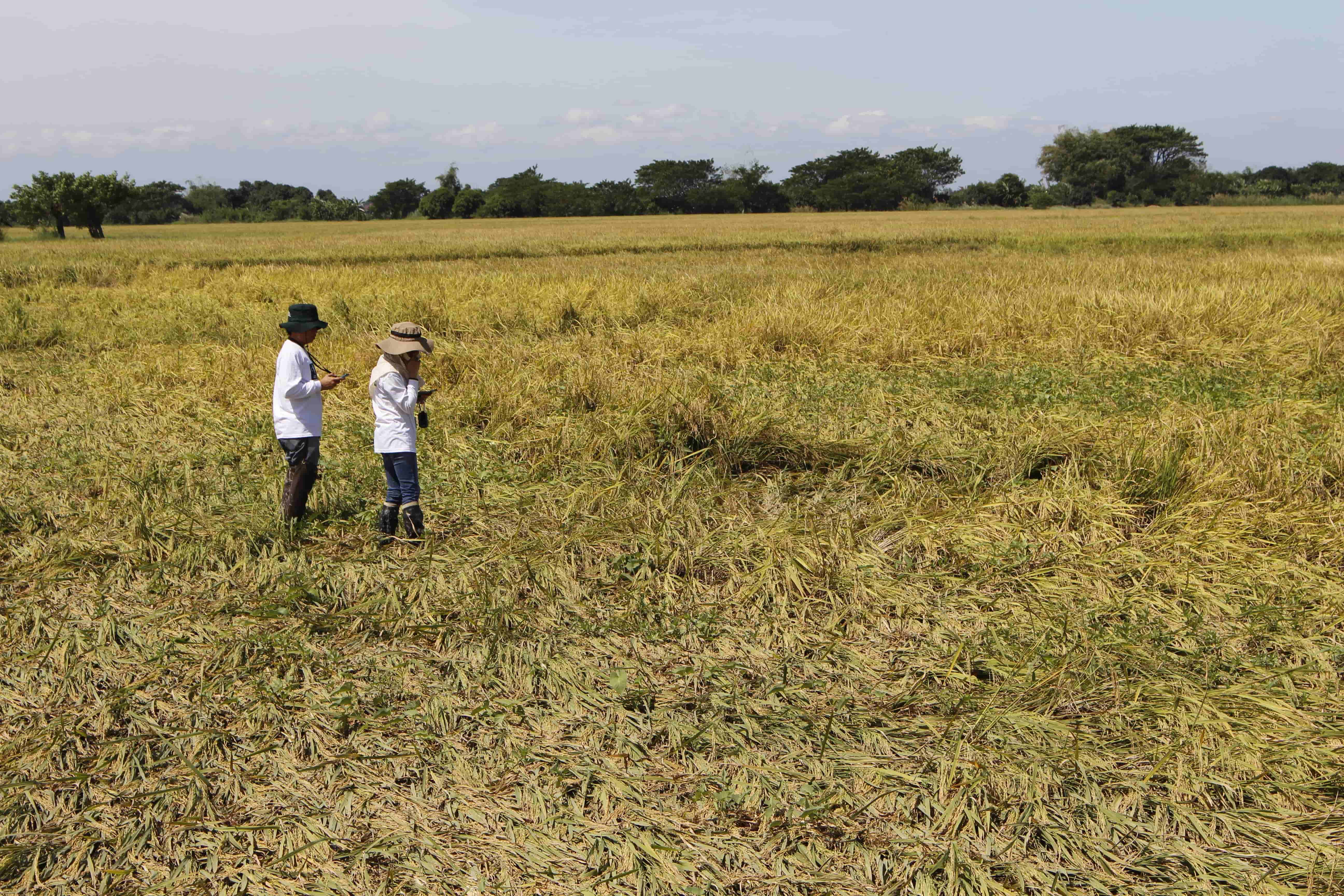
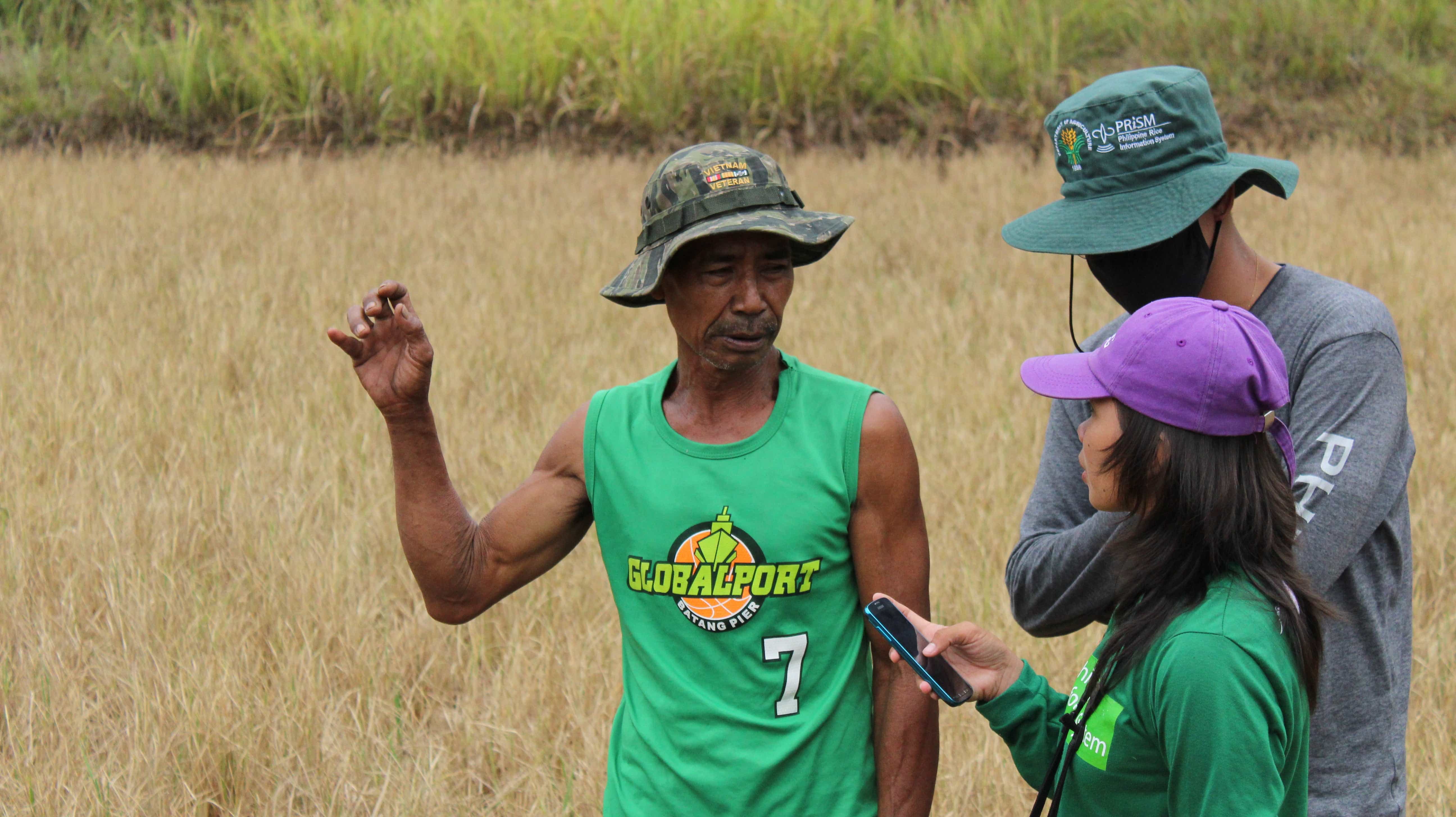
Field monitoring visits, in selected rice fields, are conducted within the cropping season to collect data on field characteristics, crop management practices, field status, crop stages, and production data. Field monitoring and validation are also conducted to assess the rice crop damages due to flood and drought.
Farmer interviews are conducted using smartphone-based forms and applications. All data collected are submitted to a secure online database for management and processing.
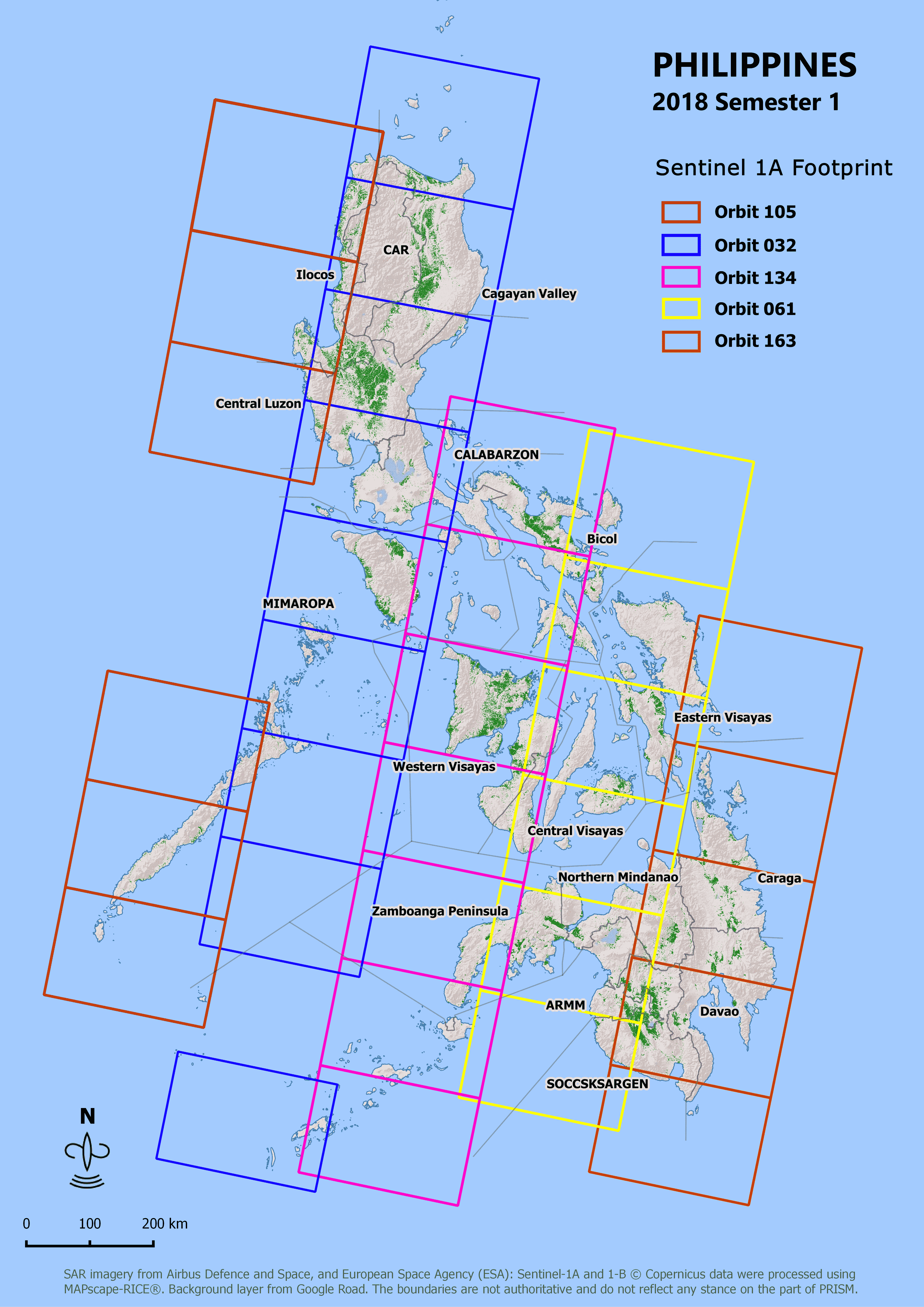
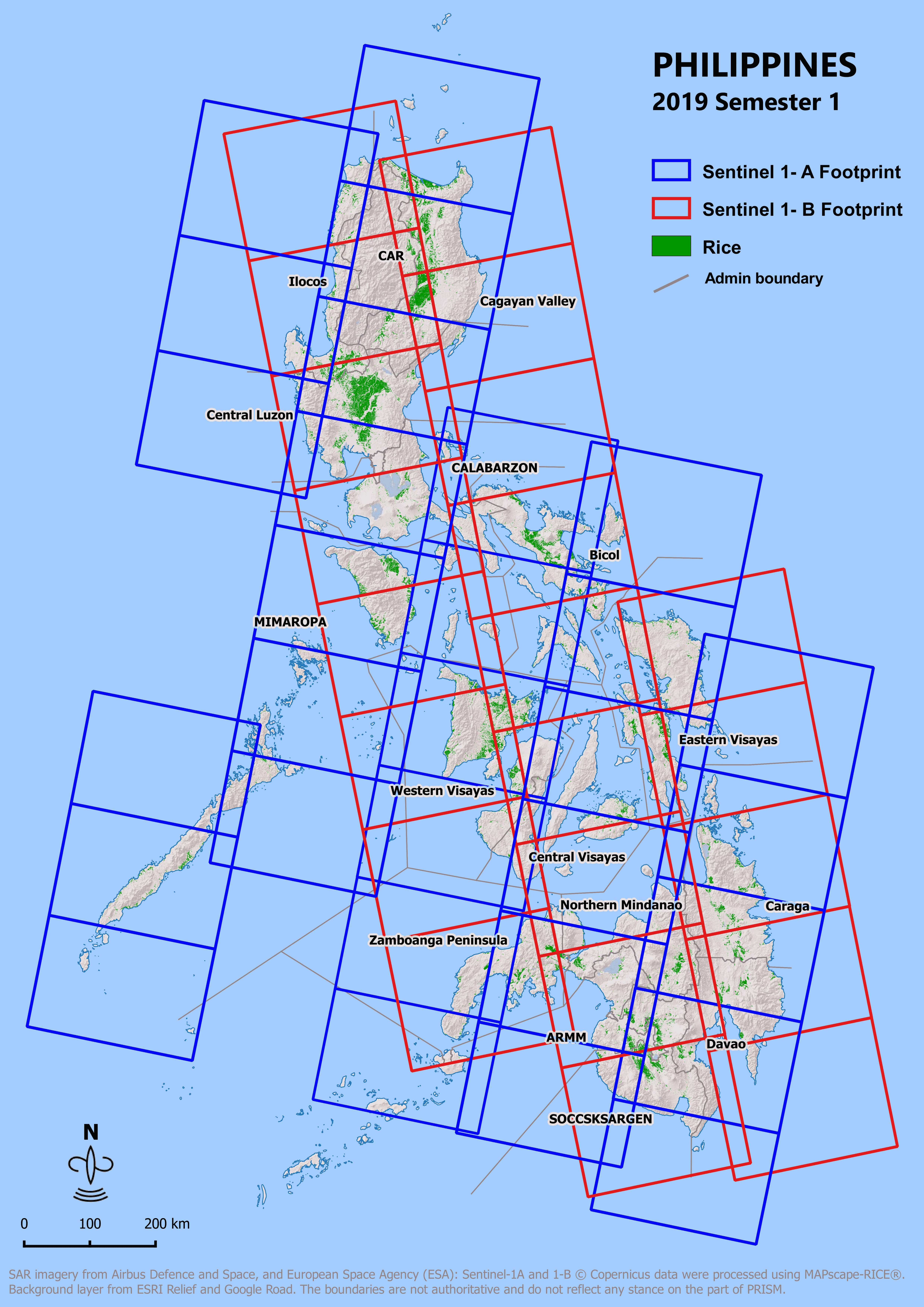
PRiSM uses Synthetic Aperture Radar images from Sentinel 1A to map the country's total rice area every cropping season. By using the mapping software (MAPscape-Rice®) developed by sarmap and the available ground data gathered from field monitoring sites across the country, PRiSM can delineate rice areas, detect rice planting dates and growth stages, identify rice areas at risk or affected by droughts and floods, and generate crop growth information needed for rice yield estimation.
The use of crop growth simulation model (ex. ORYZA) is the backbone of the PRISM rice yield estimation system due to its capability to capture the complex and dynamic interactions among rice genotypic characteristics, environment, and crop management as well as their collective effects on rice growth and yield. The minimum data requirements of crop models to simulate the rice growth and yield are daily weather, soil profile information, agronomic practices, and varietal characteristics.
PRISM regularly conducts training and retooling workshops to strengthen the capacity of its technical staff and DA regional implementers to carry out their tasks competently. Other capacity-building activities of PRiSM are establishing networks and collaboration with other government agencies, sustaining engagement with local partners, development and integration of system infrastructures, and continuous updating of PRiSM operational protocol.
In the occurrence of extreme weather events (tropical cyclone, flood or drought), PRISM provides estimate of rice areas at risk and rice areas affected by flood (using Synthetic Aperture Radar images) or drought (using optical images). This information is necessary to devise interventions, emergency aid and assess potential rice production shortfalls.


Official Gazette
Office of the President
Official Directory
Official Calendar
Office of the President
Office of the Vice President
Department of Education
Department of Interior and Local Government
Department of Finance
Department of Health
Department of Science and Technology
Department of Trade and Industry
Senate of the Philippines
House of Representatives
Supreme Court
Court of Appeals
Sandiganbayan
Court of Tax Appeals
Judicial Bar and Council

All content is public domain unless otherwise stated.